On Thu, December 2, 2004 10:04 pm, Chris Reck said:
>
> I'm now using Microsoft Streets and Trips. I can draw a straight line
> from
> one start to multiple points to see how far things are. I can also start
> at
> a point and tell it how many miles to drive and it will draw a ring on the
> map showing everywhere I can drive (straight there) within the time frame.
Yeah, this is a really old message. I was organizing some of my archived
e-mail and came across this.
So, Chris... are you still keeping up with the discussion here? If I
understand your post, it sounds like you could, for example, generate a
map that shows everything within a 2 hour drive of Denver, or even one of
the race tracks if we decided to pick that as a definite event point. Is
that correct?
Something like that would be really useful for defining the search area
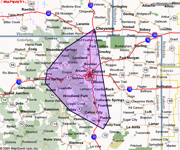
that we're looking at for campgrounds. So far what we have is
http://www.dakota-truck.net/meet/2006national/denver_p.gif
which Jon and I came up freehand just as a wild guess of what our area of
interest is going to be. If you can come up with something better, would
you mind taking a shot at it?
Much appreciated.
--
Jason Bleazard  http://www.bleazard.net  Burlington, Ontario
his:  '95 Dakota Sport 4x4, 3.9 V6, 5spd, Reg. Cab, white
hers: '01 Dakota Sport 4x4, 4.7 V8, Auto, Quad Cab, black
This archive was generated by hypermail 2b29 : Sun May 01 2005 - 01:40:55 EDT